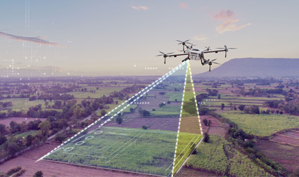
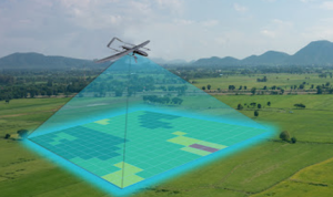
Mapping services and topographical surveys provide accurate data essential for planning and development. They help identify land features, elevations, and boundaries, ensuring informed decision-making and reducing project risks. These services improve project accuracy, preventing costly errors and delays during construction. By offering detailed insights, they support efficient resource allocation and compliance with regulations. Overall, they form the foundation for successful and sustainable project execution.
Welcome to VisionAir
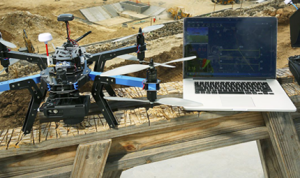
Mapping drones assess damage levels and transmit real-time data to ground personnel. Compared to traditional methods, using drones for disaster zone mapping offers cost savings and faster response times. Drones can be swiftly deployed, generating high-resolution 3D maps, pinpointing damage hotspots, and uploading data in real-time to coordinate rescue efforts. Unmanned Aerial Vehicles, especially, have made significant advancements in disaster response.
Benefits of Mapping Services / Topographical Survey

Have a general question concerning Perfect, find below contact details our team will help you.
Gobichettipalayam, Erode , Tamilnadu - 638 476.
+91 8056439087
info@visionair.in